
NASA images show more than 820 square kilometres of farmland transformed by the world’s largest cluster of plastic greenhouses
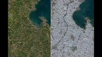
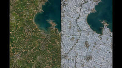
As seen in 1987, much of the landscape surrounding Weifang in eastern China appeared to be typical agricultural land from space. The land was covered by vast stretches of cultivated fields in the North China Plain. Almost four decades after that, the landscape looks very different from what it used to be. The landscape is dominated by the white and transparent roofs of greenhouses, packed so densely that satellite images resemble a sea of plastic.According to a Nature Food study, greenhouse cultivation covered about 1.3 million hectares globally in 2019, with China accounting for about 60% of the total. NASA Earth Observatory’s comparison of Landsat images from May 7, 1987, and May 20, 2024, shows the transformation around Weifang, where the world’s largest greenhouse cluster now covers more than 820 square kilometres. The research found that greenhouse cultivation expanded particularly rapidly in China after 2000.From open fields to a sea of plasticThe change is particularly striking in Weifang, a prefecture-level city in Shandong Province. NASA’s Landsat imagery shows broad areas that appeared as open farmland in 1987 becoming densely covered with greenhouse structures by 2024. From above, many of these structures appear white because their roofs are made from opaque or translucent plastic, creating a sharp contrast with the darker tones of uncovered fields.The expansion does not represent the disappearance of agriculture, but a major shift in how farmland is used. In Weifang, greenhouses allow farmers to grow vegetables such as cucumbers, eggplants and tomatoes for markets across China. Higher-value crops, including strawberries, grapes, kiwifruit and dragon fruit, have also become increasingly important, helping turn the landscape into one dominated by intensive protected cultivation.Satellites reveal decades of agricultural intensificationThe scale of the transformation is difficult to grasp from ground level. Individual farms may contain only a small number of structures, but satellite imagery allows researchers to see thousands of them together and track their expansion over decades.A study published in Remote Sensing reconstructed the annual distribution of agricultural greenhouses across Shandong from 1989 to 2018 using Landsat imagery. The researchers created maps at 30-metre resolution, producing a continuous record of greenhouse expansion over three decades. Their work showed how remote sensing can distinguish greenhouse structures from open cropland and other surfaces, allowing the gradual conversion of the agricultural landscape to be followed year by year.The longer record helps put NASA’s 1987 and 2024 images into context. The change did not happen in a single construction boom. Greenhouses accumulated progressively as protected agriculture became established and expanded across the region. Shandong was already one of China’s leading greenhouse-farming provinces, and the research identified the early 1990s as the period when large-scale specialised greenhouse vegetable production began to develop strongly in the area.
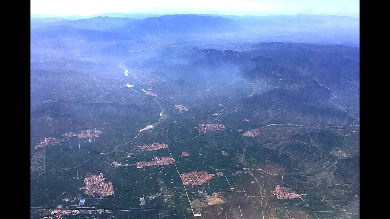
Aerial view of the Sanggan River South Plain near Zhuolu City in Zhangjiakou, Hebei Province, China. Image credit: Wikimedia Commons.
More food, but a changing landscapeProtected cultivation allows farmers to grow crops under controlled conditions and extend production beyond the normal outdoor growing season. The Nature Food study found that greenhouse agriculture has expanded rapidly in recent decades, particularly in China, while noting that its environmental and social effects vary by region.Weifang’s satellite imagery shows changes in agricultural practices rather than the disappearance of agriculture. The images show how open fields were progressively covered by greenhouses as protected cultivation expanded across the area. What appears from the ground as many individual farms becomes, from above, a vast expanse of plastic-covered greenhouses. Comparing the 1987 and 2024 Landsat images shows that the land remained agricultural but looked dramatically different by 2024. Open fields had been enclosed by plastic coverings, creating one of the world’s largest concentrations of greenhouse agriculture. The transformation shows how protected cultivation has reshaped the Weifang landscape.